
Western Wood Project, Australia
The Western Wood Project is located in the northwest of New South Wales and consists of two granted exploration licences, covering 298km2 which are considered prospective for gold and base metals. Trinity One holds rights to 80% the project secured through a Joint Venture agreement with the registered holder.
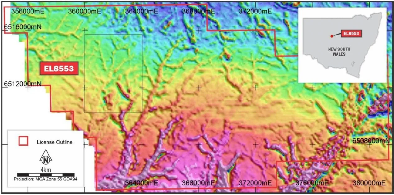
EL8553 is located 15km west of the Cobar Goldfield and CSA copper mine. Rock types in the licence are dominated by sandstones and siltstones of Devonian age with shallow cover in places. The main prospect is a gravity anomaly in the northwest quadrant where a recent gravity survey and geophysical modelling resulted in the definition of a 1.5 x 1.5km target zone of anomalous density occurring at a depth of 130 to 400m. Proposed follow-up includes mapping, rock sampling, and aircore drilling.
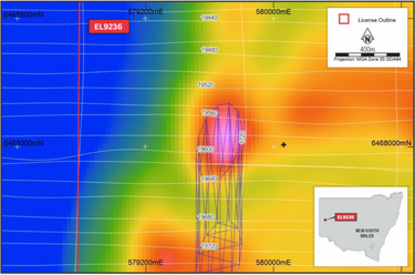
EL9236, is located 45km east of Broken Hill and its world-class silver-lead-zinc deposits. Analysis of the significant amounts of historical exploration has identified a large area of anomalous base metal geochemistry and elevated rare earth element geochemistry associated with a north-trending structure. Lying within this zone is a coincident aeromagnetic and gravity anomaly. Geophysical modelling indicates a good fit to the data was achieved by a 250 x 130m elliptic pipe plunging to the south with a depth-to-top of ~160m. Trinity One plans to undertake mapping, rock sampling, soil geochemistry, ground magnetic and gravity geophysical surveys over the anomaly to define drilling targets.